Overview
ArcGIS CityEngine provides 3D GIS for urban design. It offers powerful tool for urban designers, planners, architects, and 3D artists to streamline workflows in urban design and planning, architecture, and the creation of 3D immersive experiences.
CityEngine employs user-defined procedural rules to generate and iterate over urban environments and scenarios using either synthetic or real-world GIS data. This technology enables rapid adjustments to the architectural style, or other features, of an urban environment to support the creation of multiple scenarios in a streamlined workflow.
The following images illustrate the application of CityEngine to a simple urban design project in San Diego, California. The project involves the redevelopment of an existing site.
Bookmark View
This image illustrates a spatial bookmark created in the CityEngine model.
Grayscale View
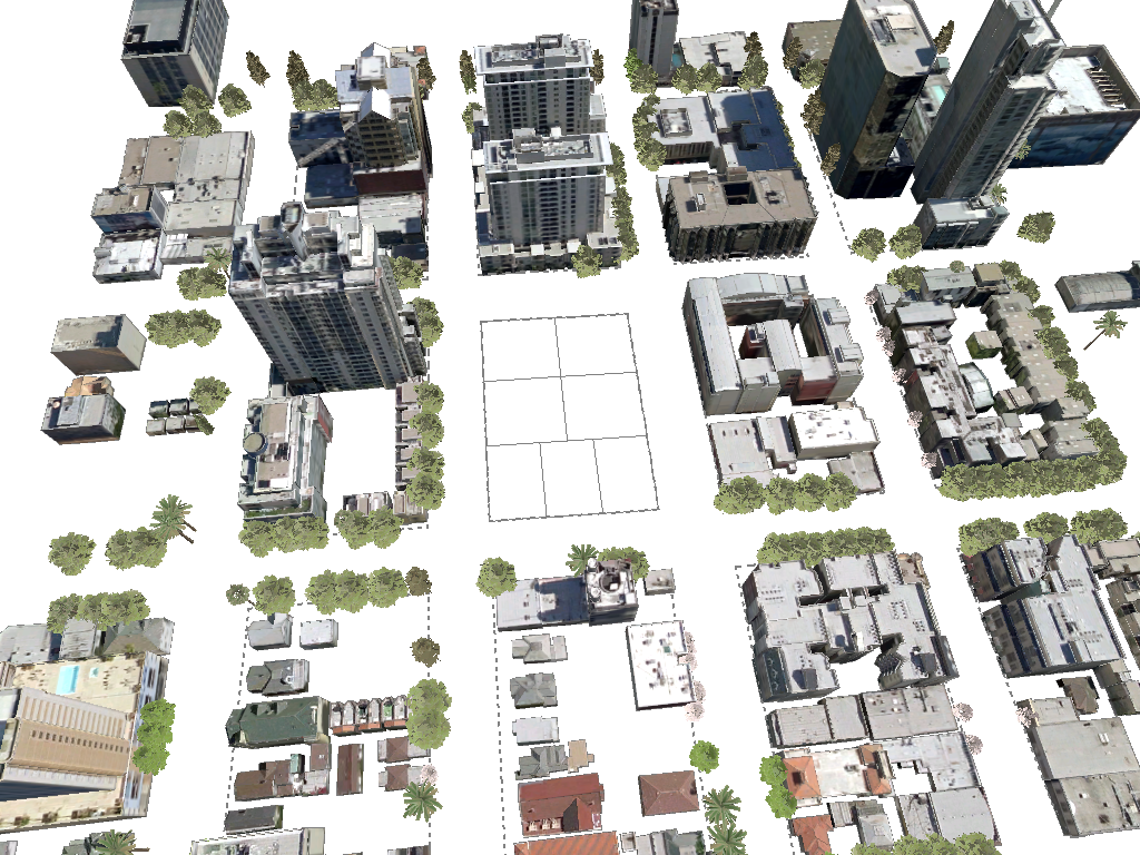
The following image shows a scene for Little Italy in San Diego before the development project starts. The view include an image basemap, streets, buildings, and vegetation layers. This image shows the buildings as grey masses.
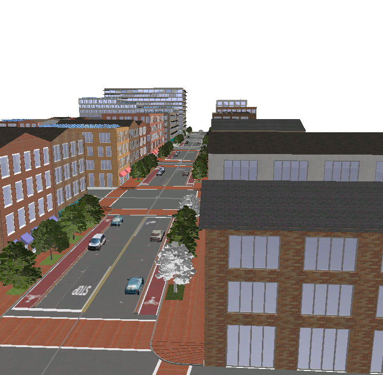
Textured View
The following image shows a scene for Little Italy in San Diego before the development project starts. The view include an image basemap, streets, buildings, and vegetation layers. This image shows the buildings with textures.
Demolished View
This image shows the proposed development site will look after the demolition phase has been completed.This image shows the area of interest for the proposed development with all existing buildings and vegetation on the site removed from the scene.
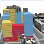
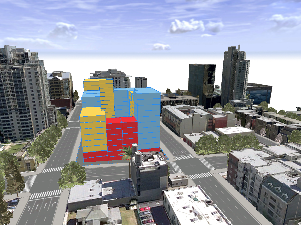
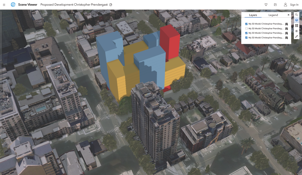
Proposed Design
This image shows the proposed design for the new development. It illustrates how the procedural rules applied to the site create a set of buildings, color-coded by use per floor.
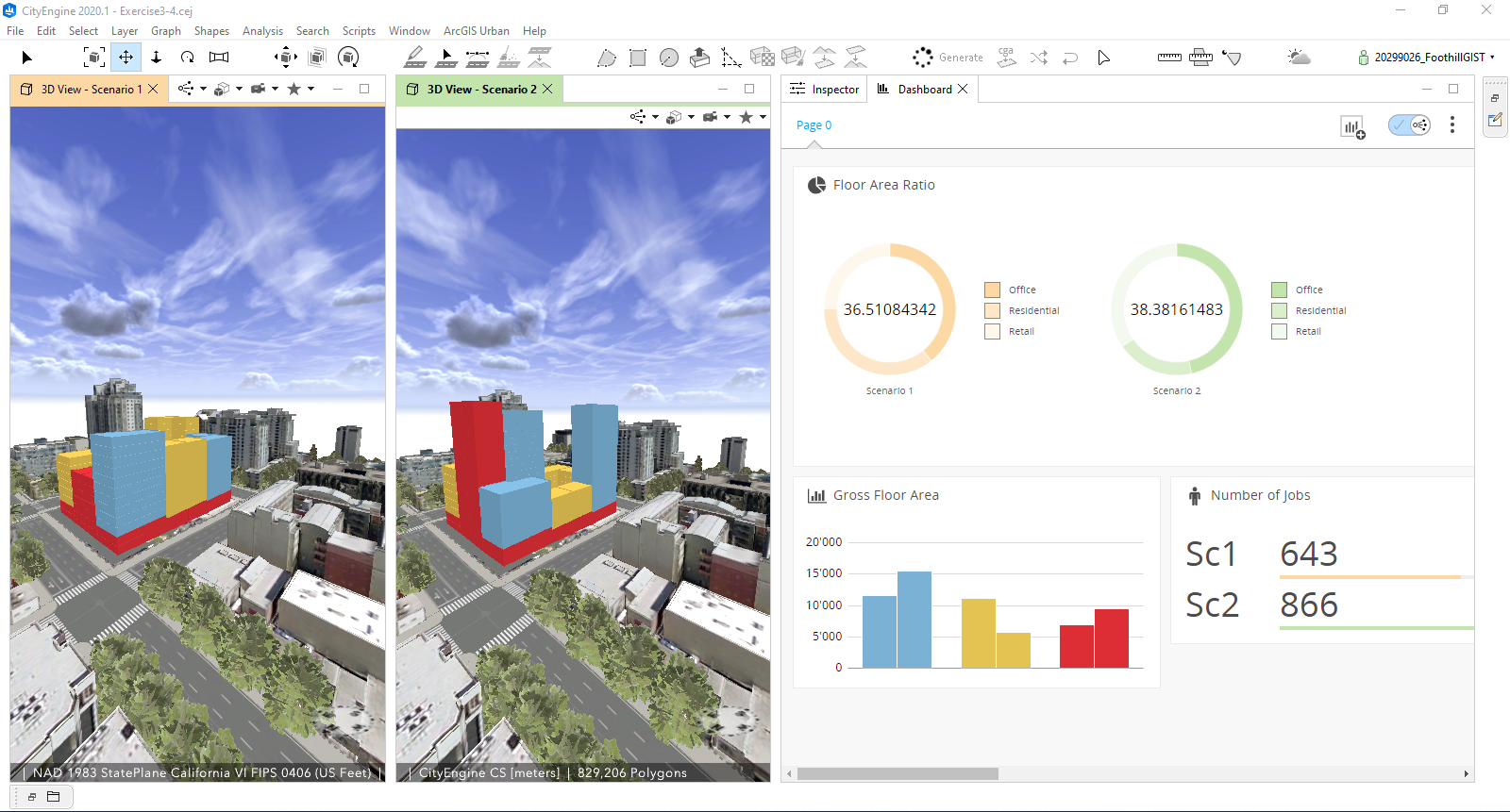
Dashboard View
This dashboard presents a side by side comparison of two different proposals. Each proposal was generated by supplying a different set of parameters to the procedural rules. The charts on the right show the total floor areas with a breakdown into office, residential, and retail areas. It also presents the estimated number of jobs generates by each proposal.
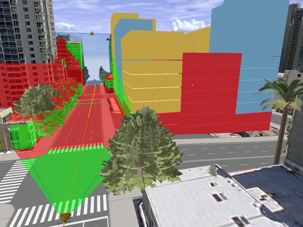
Visibility Analysis
This image shows the results of a view dome analysis applied to the proposed design. It illustrates anticipated visibility from point of view of a pedestrian standing in the middle of the crosswalk looking down the street. The pedestrian will have an unobscured view of the green areas. The red areas will be obstructed from this perspective.
ArcGIS 3D Scene Viewer
Scene Viewer is a dedicated web app for visualizing geospatial data in 3D. It enables easy exploration, analysis, and presentation of 3D GIS content on desktops and mobile devices. Publishing scenarios generated by CityEngine via Scene Viewer offers stakeholders an interactive 3D immersive experience which allows them to visualize, explore, and evaluate alternative proposals.
Click here to explore an online interactive webscene of the proposed development on ArcGIS.com.