GIS Meetup & Educational Seminar Summary #6
Presented on: June 1st, 2020.
Presenters:
- Terry Bills – Transportation Industry Manger, Esri
- Omar Maher – Director, AI, Esri
- Daniel Wilson – AI Lead, Esri
- David Yu – Data Scientist, Esri
Overview
This webinar shows how transportation agencies can apply Artificial Intelligence (AI), Machine Learning (ML), and Deep Learning (DL) in ArcGIS to gain greater insights from their data.
The topic is introduced with a reference to the book “The Second Machine Age” by Erik Brynjolfsson, Andrew McAfee. According to these authors, sophisticated algorithms can help us better manage our increasingly complex systems.
Transportation Applications
Specifically, AI can be applied to question of critical interest to transportation agencies including:
-
Safety analysis
-
Asset extraction and change detection
-
Right of way management
-
Traffic and passenger counts
-
Traffic management
-
Autonomous vehicles
Railroad Applications
In addition, this technology can also help railroads in the areas of:
-
Track and bridge clearance
-
Track geometry/predictive maintenance
-
Right of way vegetation management
-
Passenger social distancing
Aviation Applications
In the field of aviation this technology can be applied to the following areas:
-
Runway safety
-
Passenger social distancing
-
Pavement management
-
Airport security systems
GeoAI patterns for Transportation
A variety of examples of “GeoAI” pattens for transportation were presented. This included the following use cases:
- Crash prediction
- Traffic analytics from video feeds,
- Road feature extraction (cracks, signs, snow levels),
- Asset extraction from lidar
Use Cases
These scenarios fit into three broad use cases, namely, feature extraction, prediction, and pattern detection.
-
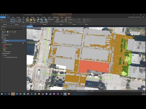
Feature extraction can be performed using DL models, for example, detecting traffic signals and signs from Lidar data. Other examples include extracting features such as building footprints, road segments, swimming pools, blight graffiti, overgrowth, and vehicles from CCTV. The feature data collected can be brough back into GIS systems for further analysis.
-
Prediction can be used to predict geospatial events and phenomena such as water pipe breaks, asthma rates, disease, crime, crashes, incidents, fires, congestion, and 911 calls.
-
Pattern detection finds statistically significant clusters and patterns which can be used to identify top risk segments, emerging hotspots for 911 calls, and disease clusters.
Demonstrations
Several demonstrations were given. The first demonstration showed crash risk prediction to illustrate that geography can be an important input to ML models. A model can incorporate factors such as weather, physical properties of the road, temporal features, and human factors. These factors can be fed to various ML models including supervised machine learning, positive unlabeled machine learning, regression models, and statistical analysis. AI models can incorporate multiple inputs from terrain, imagery, demographics, weather, road geometry, 3D buildings, and network datasets. Using ArcGIS, it is possible to enrich road segments with demographic data, geometric and contextual features of the road, road curvature (inverse curve radius), 3D information such as the terrain, line-of-site data from 3D Analyst tools, and time-of-day information. Making the correct selection of input features is more important than building the model itself.
The second demonstration illustrated activity detection from CCTV feeds for citywide traffic management. Making this data available in real-time allows better decision making. It can also generate fine-grained data that was previously impossible to obtain. The demonstration showed the integration between ArcGIS and the Nvidia Metropolis video analytics framework via the Kafka distributed message streaming system. This system can be used to look for anomalies in traffic patterns that indicate possible crash incidents.
The third demonstration featured crowd detection for event management. This is an example of feature extraction from CCTV imagery and oriented imagery using the deep learning capabilities of ArcGIS. This was followed by a confusing mishmash of “GeoAI” technologies that could possibly be used by transportation agencies.
Reaction
From my perspective, this presentation was a bit of a train wreck! The presentation lacked a strong theme to motivate the audience’s attention and instead relied on spewing a smorgasbord of technology, jargon, and buzz words. It was hard to follow what was being presented without a framework to hold everything together.
I think the presenters were trying to say that Esri has the capabilities to do everything transportation departments need without really getting into specific details. However, I found the demonstrations frustrating because I felt they did not explain why GIS technology was needed to solve these problems. It felt more like a generic Artificial Intelligence presentation. I came away wondering why I would need ArcGIS to do this. Perhaps it was just a bad day for these presenters.