GIS Meetup & Educational Seminar Summary #3
Presented on: August 24th, 2018
Presenters:
- Rohit Singh (rsingh@esri.com) – Lead developer for the ArcGIS API for Python.
- Alberto Nieto (anieto@esri.com) – Solution engineer.
Overview
This talk introduces Deep Learning, explains how it can be useful, gives some examples of its use, and offers a preview of some future developments connected to this technology.
Deep Learning in Context
Deep Learning is the newest and most specific addition to a hierarchy of technologies which include Artificial Intelligence (AI), Machine Learning (ML), and Deep Learning (DL).
-
AI is used in the fields of computer vision, video game behavioral AI, natural language processing, and speech recognition.
-
ML is used to learn from data. DL enables adaptive learning like the human brain.
-
DL can solve complex problems using layered algorithms such as neural networks that consume vast quantities of training data and computing power.
One of the newest developments in DL are convolutional neural networks. DL can be applied to the problems of image classification, object detection, semantic segmentation, and instance segmentation. ArcGIS integrates with many DL frameworks such as PyTorch, Keras, CNTX, TensorFlow, first.ai, IBM Watson, aws, and scikit-learn.
Applications and Integration with various frameworks
The talk includes several interesting demonstrations of DL showcasing integration with a wide variety of different frameworks as follows: -
-
Monitoring pedestrian activity near a baseball park using video feeds and controlling traffic signals accordingly. This is an example of image classification using the IBM Watson module integration.
-
Finding swimming pools in residential parcels from satellite images. This is an example of object detection using the integration with Jupyter, PyTorch, and fast.ai.
-
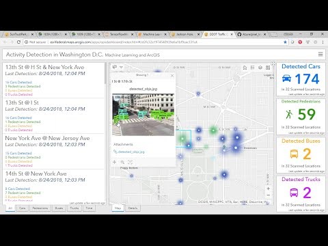
Counting traffic in real time from live video feeds. This is an example of object detection using the integration with TensorFlow.
-
Land classification from satellite imagery. This is an example of semantic segmentation using the integration with Microsoft CNTK.
-
Road detection from satellite imagery. This is an example of semantic segmentation using U-net.
-
Creating building footprints from satellite imagery. This is an example of instance segmentation using Mask R-CNN.
-
Generating maps from satellite imagery. This is an example of using image translation via adversarial networks using CycleGAN to perform multimodal unsupervised image-to-image transfer (MUNIT).
-
Generating map art using neural style transfer. This technique can be applied to maps as cartographic style transfer.
Conclusion
The talk concluded with some suggestion on how to get started, where to find additional resources, and questions and answers.
Reaction
It was inspiring to see examples of the application of deep learning technology to the field of geospatial analysis. I can see many potential applications of this technology to the field of renewable and alternate energy which I am interested in. I believe this is a growth area and something I would like to get more involved with. Unrelated to geospatial analysis, I was impressed the demonstration of using adversarial networks to transform the video of a zebra into a horse and back again. This appears to be enormously powerful technology! I now have a better understanding of just how real the threat of “deep fake” videos is.