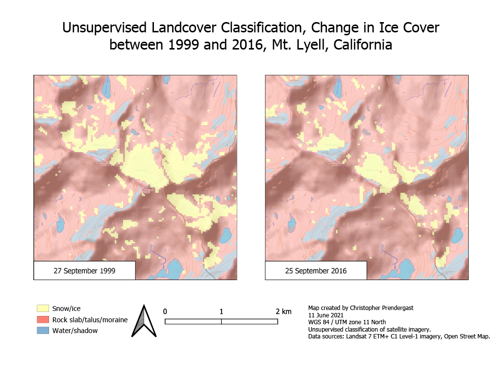
A study was conducted using remote sensing imagery to quantify the change in area over time of the Lyell glacier in Yosemite National Park, California. This analysis was performed using Landsat 7 imagery captured in late summer when it is easiest to distinguish permanent snow fields from other snow deposits. Mount Lyell is well known as the location of one of the few remaining glaciers in Yosemite. The glacier on Mount Lyell has been shrinking due to the impacts of global climate change. Today, the Lyell Glacier is considered a permanent snow field rather than a living glacier because it has ceased to flow. The extent and change in the area of permanent snow was assessed using the Normalized Difference Snow Index (NDSI), and both supervised and unspervised land cover classification techniques. The analysis was performed using QGIS software.
Report
Full report containing the analysis is available here:
Presentation
Presentation accompanying the report is avaialble here: