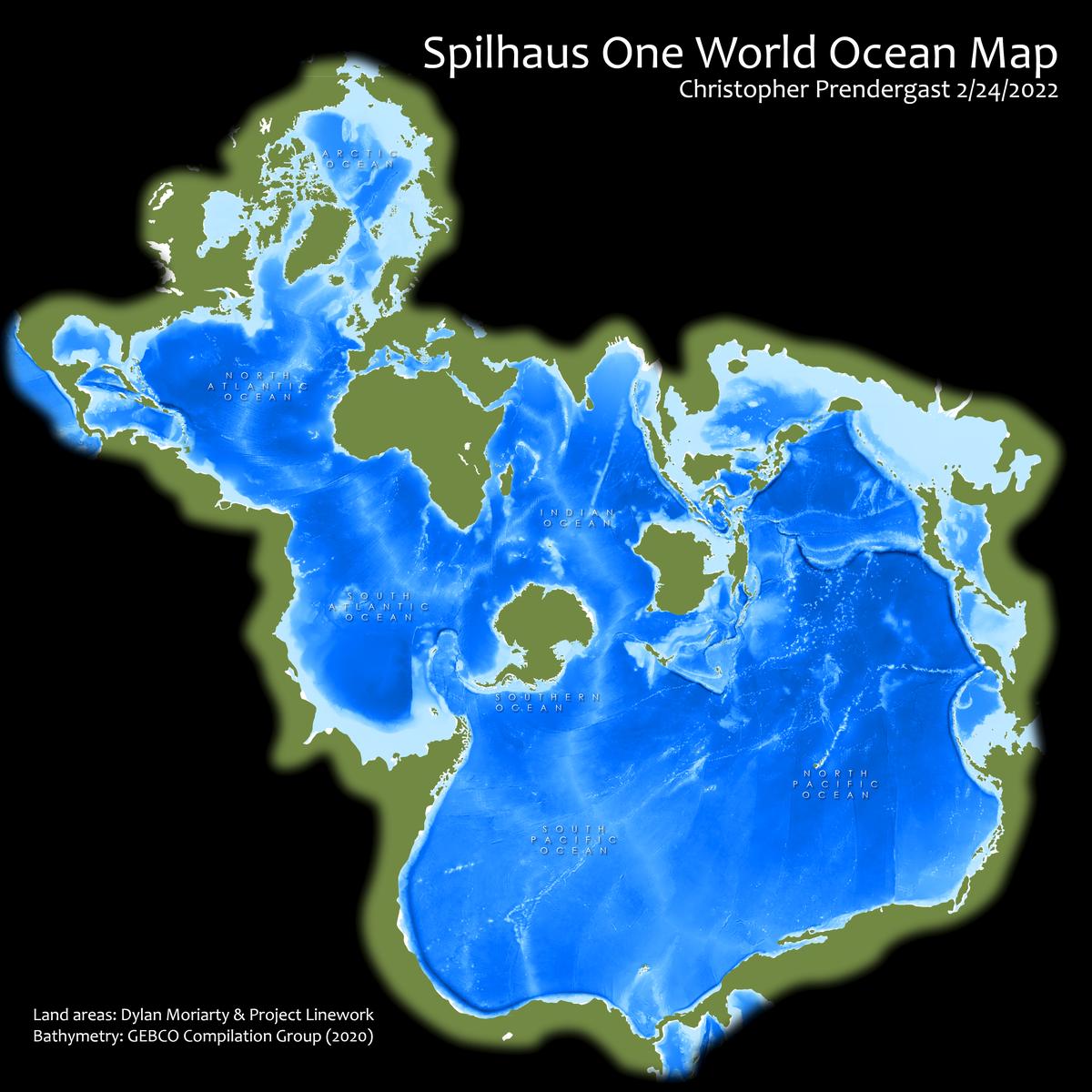
Spilhaus World Oceans Map
This map uses the to illustrates the connectivity between all of the world's oceans. It is based on the Spilhaus projection. Athelstan Spilhaus designed his world ocean map in 1942. This is the result of an exercise from Esri's Cartography MOOC which involves the explicit manipulation of spatial references and coordinate systems.