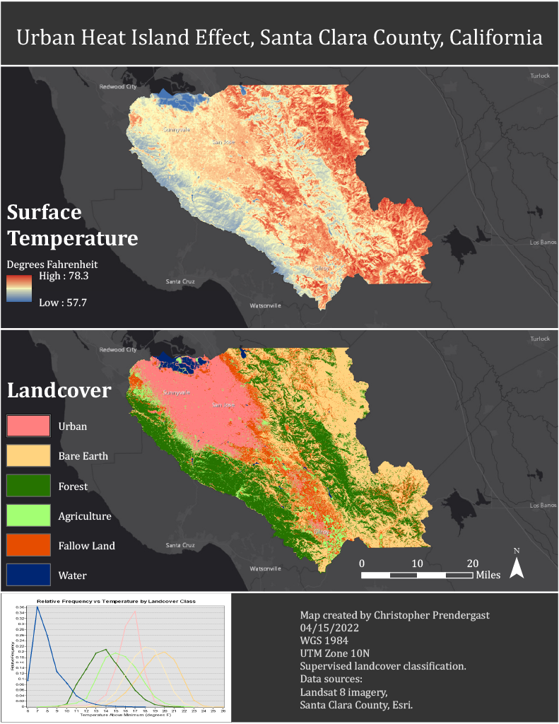
An analysis of land surface temperature by landcover class for Santa Clara County derived from Landsat 8 imagery and a supervised image classification. Presents results in maps, charts, and tables. Draws conclusions, identifies limitation of this study, and suggests areas for further study.
Urban Heat Map
Project Report